Península Valdés is not a single uplifted block shaped in one event. Its visible form records ancient marine sedimentation, repeated sea-level changes, erosion, wind transport and the accumulation of beach ridges that eventually connected older land areas to the continent through the Istmo Carlos Ameghino. The result is a low peninsula bordered by cliffs, gravel beaches, dunes, gulfs and saline depressions.
The foundation: sediments from changing seas
Coastal cliffs expose layers deposited when seas advanced across northeastern Patagonia and later retreated. The Puerto Madryn Formation is especially known for late Miocene marine sediments and fossils, evidence that environments here were very different millions of years ago. Younger continental and coastal deposits overlie and reshape that older record.
Sea-level cycles rebuilt the coastline
During the Quaternary, global glacial cycles repeatedly locked water in ice sheets and released it again. Shorelines shifted. Waves cut platforms and cliffs during high stands, while falling or stable seas left beaches and ridges. These former shorelines help geologists reconstruct coastal evolution.
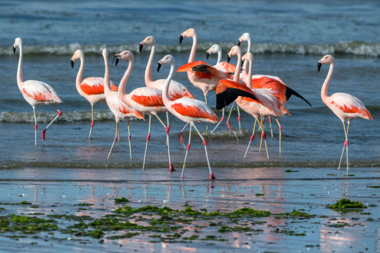
Birdwatching Whole Day Tour
Embark on a full-day birdwatching adventure in Patagonia, discovering the diverse avian species of the Peninsula Valdés region.
- Puerto Madryn
From Price: USD 1290
How the isthmus developed
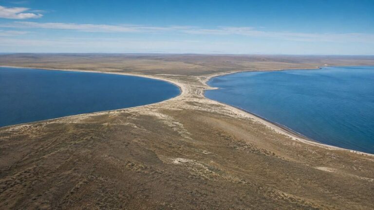
The narrow Istmo Carlos Ameghino separates Golfo San José from Golfo Nuevo and joins Península Valdés to mainland Patagonia. It is best understood as an accumulative coastal connection shaped by sediments, waves, currents and changing sea level—not as a simple bridge suddenly raised from the ocean.
| Stage | Dominant process | Visible legacy |
|---|---|---|
| Miocene seas | Marine sedimentation | Fossil-bearing coastal strata |
| Later uplift and erosion | Exposure and incision | Cliffs and dissected layers |
| Quaternary sea-level cycles | Repeated shoreline migration | Marine terraces and beach ridges |
| Modern coast | Waves, currents and wind | Dunes, spits, beaches and changing inlets |
Why the interior contains salt flats
Salina Grande and Salina Chica occupy closed depressions below the surrounding terrain. Water entering these basins has no normal outlet to the sea. Evaporation concentrates dissolved salts, creating surfaces whose appearance changes with rainfall and season. They are not exposed patches of ocean trapped yesterday, but products of basin geometry, aridity and long-term water balance.
Puerto Madryn – 2 night traditional program
Check best season to see whales and penguins in the area
Caleta Valdés is still changing
Caleta Valdés is a long coastal inlet separated from the Atlantic by a narrow gravel barrier. Waves and longshore transport move sediment along the coast, while storms can alter openings and ridge shape. It is a useful example of geology as an active process rather than a finished history.
Cliffs, fossils and visitor safety
Erosion continually exposes new material but also destabilizes cliff faces. Do not climb, excavate or remove fossils. Observe from authorized paths and report significant finds to the relevant authority. The existing guide to the area’s paleontology explains the fossil record in more detail; this article focuses on landform evolution.
In itinerary design, geology is most valuable when it connects stops: the isthmus, salt flats, cliffs and Caleta Valdés become parts of one evolving system rather than unrelated viewpoints.
A landscape still under construction
Wind shifts dunes, waves sort gravel, cliffs retreat and salt basins respond to water balance. Human lifetimes capture only a small interval, but the processes visible today continue the same geological story.
Puerto Madryn & Puerto Piramides – 4 nights
Check best season to see whales and penguins in the area