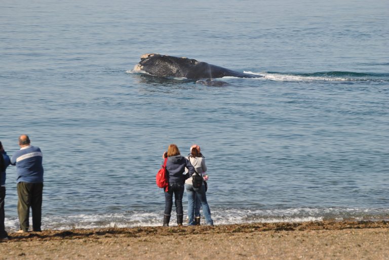
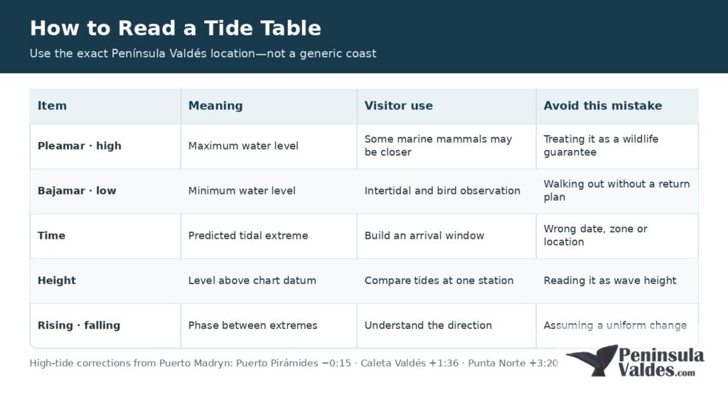
The official Península Valdés 2026 schedule uses Puerto Madryn as the reference port and applies local corrections. For high tide, Punta Norte is 3 hours 20 minutes later than Puerto Madryn, Caleta Valdés is 1 hour 36 minutes later, and Puerto Pirámides is approximately 15 minutes earlier. The simplest and safest method is to use the official table for the exact visitor site rather than calculate it from a generic tide app.
| Item | What it means | Visitor use | Common mistake |
|---|---|---|---|
| Pleamar / high tide | Predicted local maximum water level | Often relevant for marine mammals close to some viewpoints | Treating it as a guaranteed wildlife time |
| Bajamar / low tide | Predicted local minimum water level | Reveals intertidal areas and can improve bird observation | Walking onto exposed ground without a safe return plan |
| Time | Predicted time of the tidal extreme | Builds the visit window | Using the wrong date, time zone or site |
| Height | Water level above the table’s reference datum | Compares the relative size of tides at the same station | Reading it as beach depth or wave height |
| Rising / falling tide | Water moving toward high / low tide | Shows the phase between listed extremes | Assuming the change is perfectly uniform |
Official tide relationships and visitor recommendations were checked on August 28, 2026. Tide predictions are not guarantees of weather, waves or wildlife.
Use the official source for the correct year
Argentina’s official tidal authority is the Servicio de Hidrografía Naval (SHN). Its tide-table service publishes predictions for Puerto Madryn and explains the corrections for secondary ports. The Península Valdés administration’s forecast and tides page converts that information into a practical schedule for Golfo Nuevo, Punta Norte, Caleta Valdés and Golfo San José.
Check that the table says the year of your visit. A screenshot from a previous season can display a plausible-looking time while being completely wrong for your date. Save the relevant day offline before leaving Puerto Madryn.
Puerto Madryn & Puerto Piramides – 3 nights
Check best season to see whales and penguins in the area
Step by step: how to read one day
1. Confirm the location
Start with the destination, not the closest city name. Puerto Madryn is the reference port for Golfo Nuevo, but the tidal phase moves around the peninsula. Select Punta Norte if you are planning an orca-viewing visit there; use Caleta Valdés for Punta Cantor and Caleta Valdés; use Puerto Pirámides for the village and its beach.
2. Confirm the date and time convention
Match the local calendar date of the visit. Read whether the source uses a 24-hour clock—common on Argentine official tables—or a 12-hour clock with a.m. and p.m. Do not convert a printed Argentine schedule as if it were UTC. If an app shows a time-zone label, confirm it corresponds to local Argentina time.
3. Identify pleamar and bajamar
On a Spanish table, pleamar is high tide and bajamar is low tide. Most days have alternating high and low tides, but the exact pattern, height and interval vary. Find the event closest to your intended visit.
4. Read the height in meters
The listed height is measured relative to that station’s chart datum. It is not the depth of water at the shoreline, not the height of a breaking wave and not a measurement above the sand where you plan to stand. Heights are most useful for comparing tides at the same station and datum.
5. Build a window, not a single-minute appointment
A predicted high tide at 13:40 does not mean wildlife appears at 13:40. It marks the expected maximum in the tidal cycle. Arrive early enough for the road, parking and walking time, then follow ranger instructions and site hours.
Why Puerto Madryn’s time changes around Península Valdés
Water does not reach all sides of Península Valdés at the same time. The SHN treats Puerto Madryn as a reference port and publishes corrections for secondary locations. The official 2026 protected-area page states these high-tide differences:
- Puerto Pirámides: about 15 minutes before Puerto Madryn high tide.
- Caleta Valdés: 1 hour 36 minutes after Puerto Madryn high tide.
- Punta Norte: 3 hours 20 minutes after Puerto Madryn high tide.
Low-tide corrections are not always identical to high-tide corrections. SHN’s secondary-port example gives Puerto Pirámides a 41-minute earlier correction for low tide, versus 15 minutes earlier for high tide. This is why simply adding the same number to every event is not reliable. Use the exact-location table whenever it is available.
How tides affect wildlife viewing
Punta Norte and orcas
The Chubut tourism authority recommends being at the Punta Norte viewpoint from three hours before until three hours after local high tide during the orca season, with calm sea conditions. That six-hour window reflects probability, not a scheduled performance. Orcas are wild animals, and a suitable tide does not guarantee a sighting.
The local Punta Norte high tide is 3 hours 20 minutes after the Golfo Nuevo / Puerto Madryn reference. Use the protected-area schedule or perform the official correction carefully. Also check road condition and unit opening hours before making the long gravel-road drive.
Adventure in Peninsula Valdés with Brunch
Enjoy a full-day adventure through Peninsula Valdés and its rich natural environments. Discover wildlife such as penguins, sea lions, and elephant seals.
- Peninsula Valdes
From Price: USD 249
Caleta Valdés and coastal wildlife
The official Caleta Valdés page recommends high tide because sea lions and elephant seals may be closer to the coast, and it is the tidal phase associated with the possibility of orca activity. Caleta Valdés high tide occurs later than Puerto Madryn’s, by 1 hour 36 minutes according to the official 2026 correction.
Isla de los Pájaros and low tide
At Isla de los Pájaros, low tide exposes a broad intertidal area. The protected-area administration recommends low tide for appreciating that environment, while bird activity can also be strong around the intertidal period. Stay in designated visitor areas; an exposed flat is not an invitation to walk toward the island.
Punta Pirámide
The official visitor-site guidance recommends low tide for a clearer appreciation of the sea lion colony from the viewpoint. This is different from Punta Norte and Caleta Valdés and demonstrates why “high tide is always best” is not a useful rule.
Tide prediction is not a weather or wave forecast
Tide tables estimate astronomical water levels. Wind, atmospheric pressure, swell and local conditions can make the observed sea differ from the prediction. A low tide does not make an exposed beach automatically safe, and high tide does not prove that a boat will depart.
Check three separate things: tide, weather and the current operational status of roads or the Puerto Pirámides port. The protected-area administration specifically recommends checking weather, tides and port status because strong wind or rain can affect navigation and internal roads.
Common tide-table mistakes
- Opening a generic “Península Valdés” app without confirming its station.
- Using Puerto Madryn high tide as Punta Norte high tide.
- Reading meters as wave height or water depth at a beach.
- Using yesterday’s date or an old annual PDF.
- Applying a high-tide correction to low tide.
- Planning an arrival exactly at the listed minute.
- Assuming tide alone guarantees orcas, whales or a boat departure.
- Ignoring the 08:00–20:00 opening hours of the main operational units.
Puerto Madryn – 2 night traditional program
Check best season to see whales and penguins in the area
My practical method
When I plan a Península Valdés day, I first choose the wildlife site, then look up that site’s local tide, then check the road and weather. Only after those three checks do I set the departure time. It prevents the most common error: planning the whole day around a Puerto Madryn number that belongs to the wrong coast.
If timing tides, wildlife and gravel-road distances feels too complicated, a guided classic Península Valdés tour can adapt the route to the day’s conditions. Ask what wildlife site is planned and whether the current tide is part of the routing decision.
Classic Peninsula Valdes
Discover the natural wonders of Peninsula Valdés on this full-day adventure.
- Peninsula Valdes
From Price: USD 130
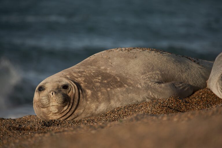
Elephant Seals: Giants of the South
Witness the awe-inspiring presence of elephant seals on an unforgettable coastal adventure through Patagonia.
- Peninsula Valdes
From Price: USD 1190

Fire & Sky in Patagonia
Savor local flavors and wine as the Patagonian sky lights up at dusk
- Peninsula Valdes
From Price: USD 890